Study area: Mong Cai city, Quang Ninh province
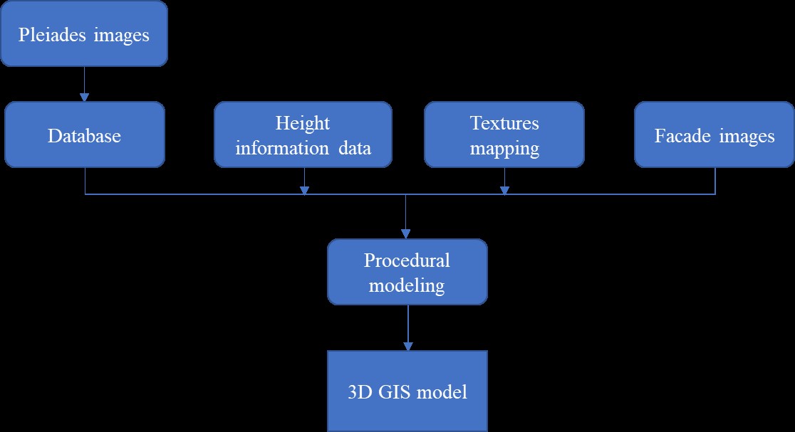
Methodology: 3D city modeling and urban visualization using the 2D GIS data is one of the most growing research topics in city planning. There are many different methods of 3D city modeling and many different applications of 3D city models. In this project, a modeling method of creating a 3D city model was implemented from CAD data and its attributes. The techniques used in the creation of a 3D GIS city model have been provided by the GIS environment and assisted by satellite images and CityEngine.
For the construction of 3D models, we first need to prepare high-resolution satellite image data (Pleiades image), height information data, textures mapping data, and facade images data, and so on. Then, we should import the high-resolution satellite image data to ArcGIS for the geographic information. Finally, we use CityEngine software to establish a three-dimensional model.


